Class III+/IV
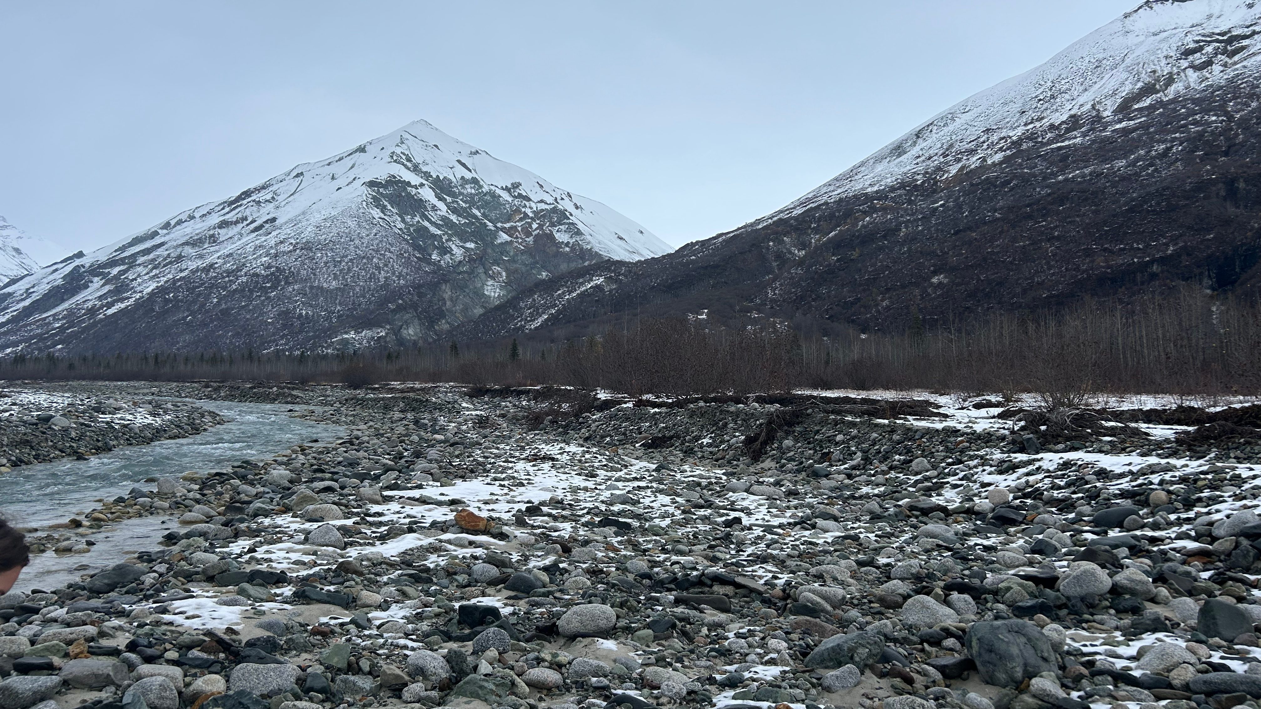
Within the Talkeetna Mountains the Chickaloon River races down a seam splitting two distinct geologic regions. Originating high in the mountains, the Chickaloon Glacier provides the water that has carved the valley into its current state. From the Chickaloon Glacier to its confluence with the Matanuska River, the ancient water descends 3,000 feet over its 40 mile run. In classic glacial fashion, the descent is continuous with a variety of braided portions, long stretches of class 2 boogie water, and a few standout class 3 rapids like Hotel Rock and The Narrows. On the west side of the river, the rocks resemble those found on Castle Peak. On the east side, the rocks take on a different nature with big waterfalls and vertical walls defining the side canyons.
The Chickaloon can be run at most flows; however, the lack of gauge can make it hard to decipher what level the river is at. Given the majority of the river’s water is coming from the Chickaloon Glacier, the color of the water can act as the best gauge. If the river is extremely murky (brown to grey), it is likely to be at high waters. When it begins to lose some of its silt and begins looking more blue, it is at medium flows. As the water transitions out of blue and approaches clear, the river is at low flows. While rafts and kayaks stand a chance to safely descend the river at higher flows, most packrafters chose to wait until late in the summer to run the river at lower flows. Typically, come late August and through September, the Chickaloon flows at a majestic light blue signaling the packrafters that it is time to paddle.
There are multiple ways to experience the Chickaloon. Most boaters choose to hike into the river, but to reach the upper stretches a flight to the 30-mile airstrip becomes the only practical option. There are multiple ways to hike into the river, from the simple option of following the trail that parallels the river as well as an option to follow the Kings River to a high pass that drops you into the Chickaloon Valley. Along with these two main hiking options there are plenty of creative ways to access the valley!
From the 30-mile airstrip, expect to find about 10 miles of braided river with very few exciting features within the water. To supplement the lack of whitewater, the Chickaloon River provides you with some of the best views on the river. You may expect to be above treeline considering the airstrip’s elevation of 2500 feet, however there is still a fair amount of aspen and other shrubbery around.The braided nature means the river bed is wide enough to open up the views both up and down stream. Along with the visual clearing that the river provides, the surrounding mountains feel massive and powerful as you begin your float. After a long warm up on braids, the river channelizes as it makes a long right bend. Quickly, the character of the river changes and it becomes a much splashier beast.
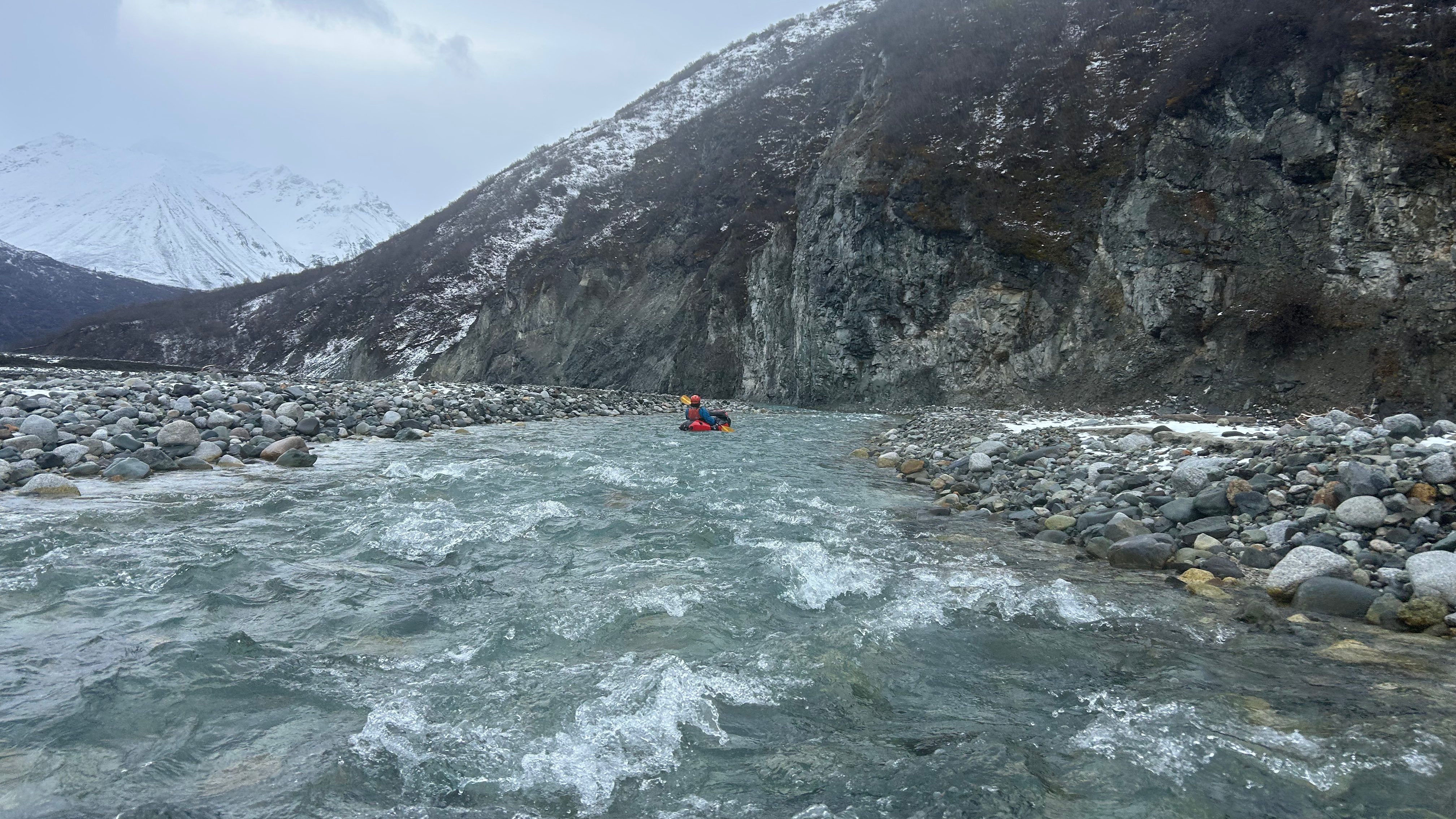
From the point the river channelizes, you can expect nearly non-stop class 2 to 3 paddling. At the point the river channelizes is a long class 2+ boulder garden that will set the tempo for what the rest of the day will look like. A few more miles of exciting boulder dodging leads you to Hotel Rock (III/IV), one of the major rapids and a rapid unlike anything I’ve seen before. The rapid is formed by a massive landslide visible on the left side of the river. This landslide deposited some of the largest boulders imaginable into the river, creating a network of sieves that creates unpredictable water. All of these rocks have the potential to hold wood, so scouting this rapid is paramount, and scouting can be easily achieved via an eddy 100 yards upstream of the first large boulder. It is recommended to scout the entirety of the rapid given the severity of the hazards the boulders create. At lower water, you are able to paddle through many of the sieves, however be aware that logjams above your head could still easily catch on you and extract you from your boat. At higher water, the rapid becomes a much bigger hazard as water surges through the sieves, threatening to take you with. Along with the dangers of getting pulled through a sieve, the water forms chaotic boils and eddy fences as a result of the quantity and size of the sieves. Confident ferry skills are necessary to safely run this rapid at higher water. Luckily, you can use the scout trail as a portage if you feel like the rapid puts too much on your plate.
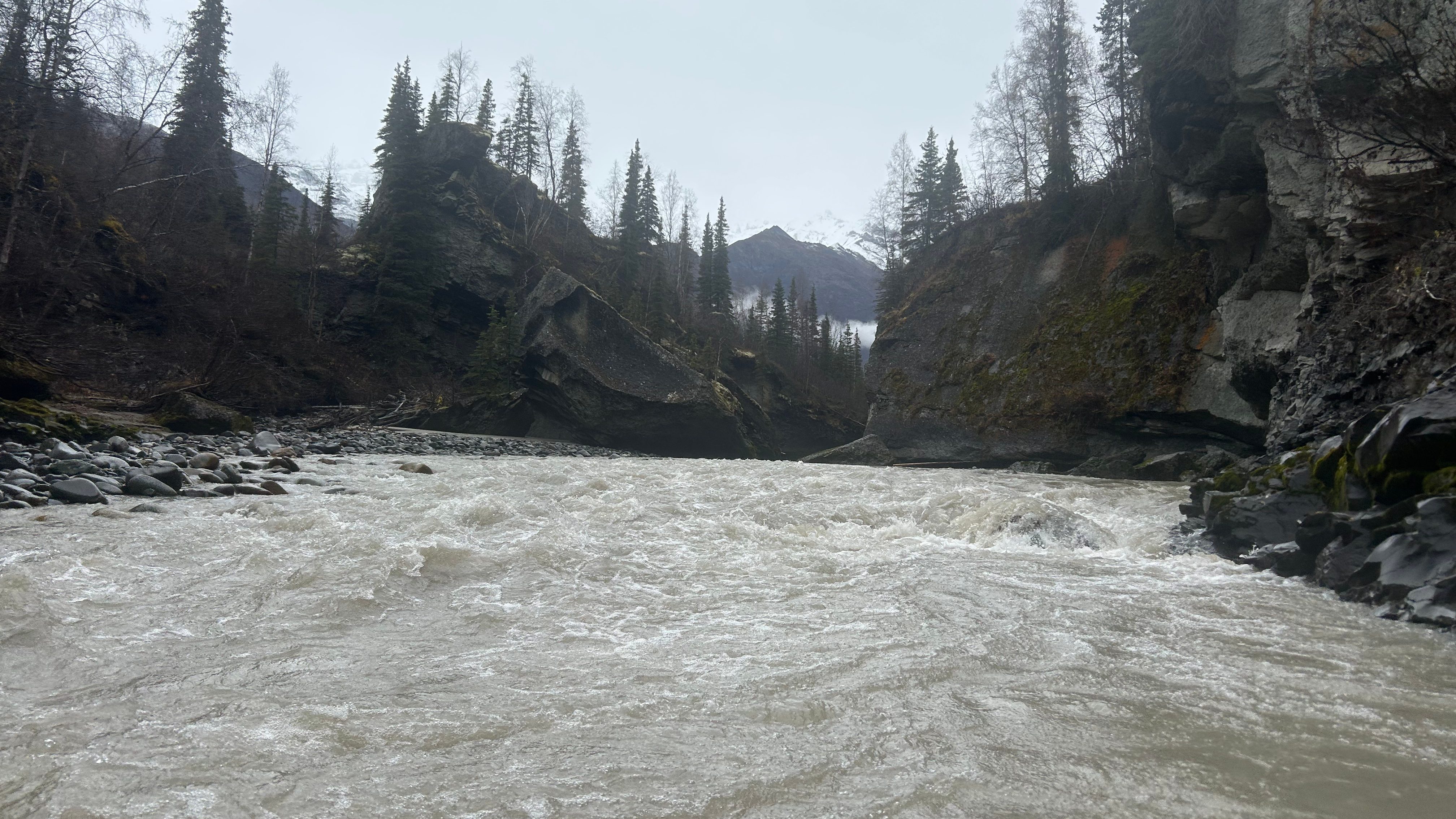
After Hotel Rock, the river settles back into its non-stop boulder garden cadence for a few miles before it eases up for a brief period. Following this break, the river enters a canyon with steep to overhanging walls. Within the canyon exists the second major rapid, Pyramid Rock (II+/III+). At the narrowest point of the canyon, the top of the canyon walls come within 10 feet of touching. This slot provides a visually stimulating rapid, but the challenge is minimal through the constriction. Just below the constriction is a massive rock named Pyramid Rock that often will hold wood on its right side. Because of this logjam potential, remaining composed through the canyon to allow for a left passage is important.
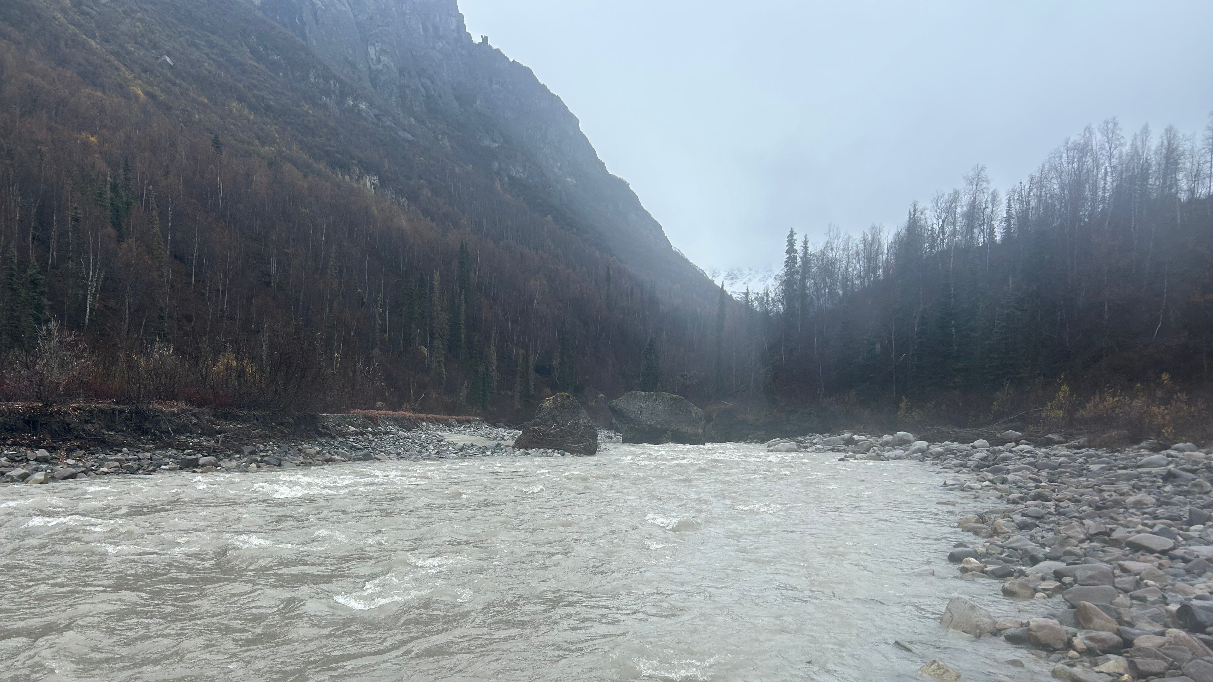
Beneath Pyramid Rock, the river finds its natural rhythm and continues as class 2 to 3 boogie water. A few miles down, you enter a shallow canyon with stunning geology at eye-level. This canyon provides fun read-and-run boating with one last major rapid. About two miles upstream from the Glen Highway Bridge is Ledge Drop (III-IV). It is scoutable from the road with large holes on the center and right sides of the drop, making a left run the ideal line. At low flows, all lines are open down the Ledge.
After Ledge Drop, enjoy the last few minutes of non-stop boogie water before the highway bridge marks the end of your journey. If you happen to miss the bridge (or want a taste of some different water), you can continue down the Matanuska River and paddle some big-water.
10/4/2025
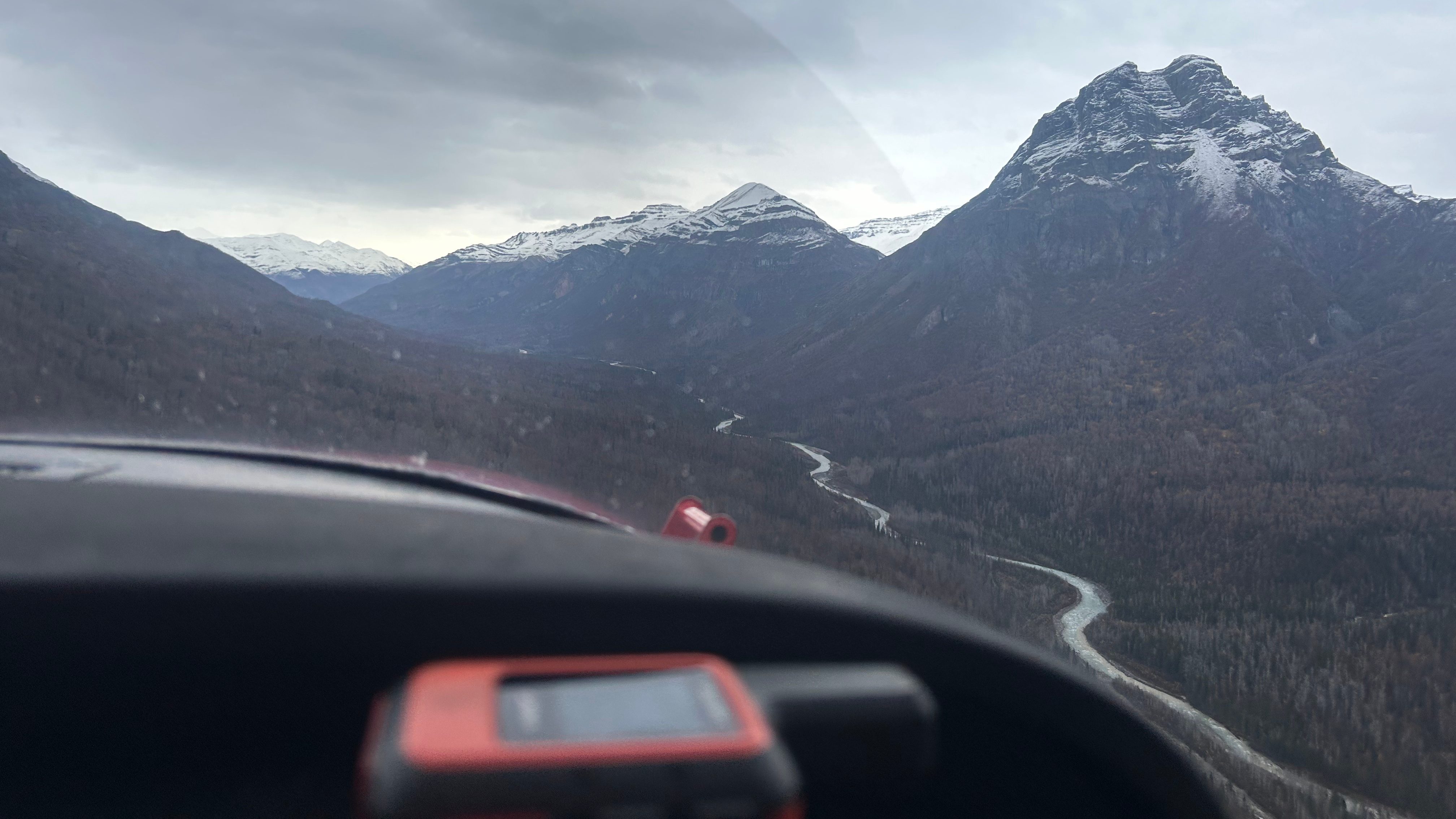
As I have slowly assimilated to the Alaskan lifestyle, I have realized this state operates on favors. Acknowledging this truth, I quickly accepted the opportunity to help a friend work on his fly-to cabin with the promise of a future flight in exchange. We loaded up into his Cessna 185 on a Saturday morning and by that evening, we had dropped much of the brush we intended to clear for the weekend. We slept easily after the day of hard work, and the next morning completed our tasks before flying home. Months had passed before it felt like the right time to call in the favor, but after a friend came back with stellar reviews about the lower 8 miles of the Chickaloon, I knew it was time to fly in. Cody was passing through town from McCarthy on the same weekend and Olga was ready to clear her calendar so the crew was decided. We met at Birchwood and loaded back into the same 185 that we took to earn this flight.
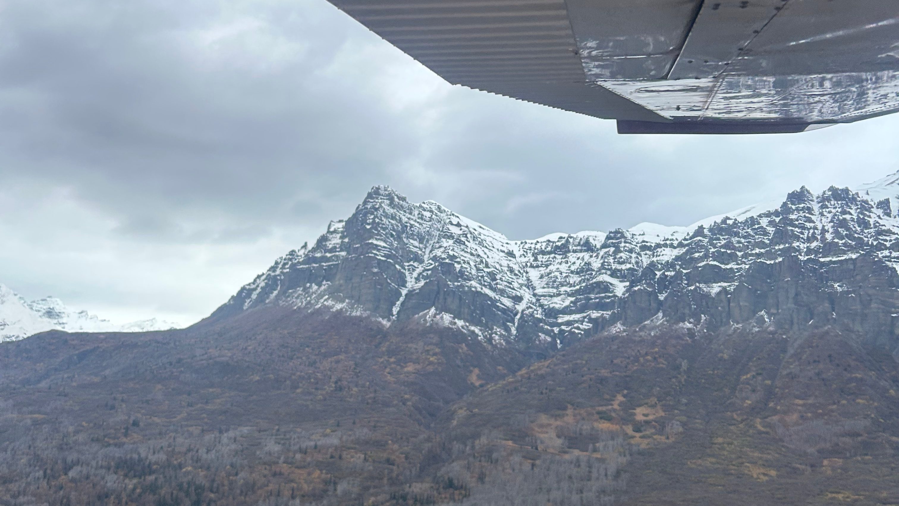
Skies were grey but the clouds were high, allowing us a safe but bumpy flight up the Matanuska valley. First, Pioneer peak whizzed past us; Matanuska, Kings, and Castle quickly followed. Through the window of the fast-moving plane, the peaks all became much smaller than they typically feel. We banked into the Chickaloon valley and things quickly changed character. The mountains began leaking broken steps of vertical waterfalls from their peaks thousands of feet above and the drainages splitting the peaks became much sharper. With uncertainty in how long the weather would hold, our pilot quickly landed after taking one pass. Before we could even shoulder our packs he was back in the air, hurrying back to his day-off from commercial flying that we had interrupted.
A short walk through well-spaced aspen led us to the river where we inflated our boats and donned our gear. The river looked more like a creek here, but frequent tributaries just downstream of us brought our hopes up. As we launched, the gin-clear water allowed for perfect views of the rocks beneath us that had been scoured from the hillside by the Chickaloon Glacier within the last ice-age. We found ourselves bumping these rocks for a couple of miles, but in no time, the river began capturing more and more water until we were no longer fearful of hitting sub-surface rocks. As the river gained water from each tributary, the color of the river changed. At one point, a tributary stained the river a deep red, I would guess from volcanic mudstone, and beyond that point you could no longer see through the water.
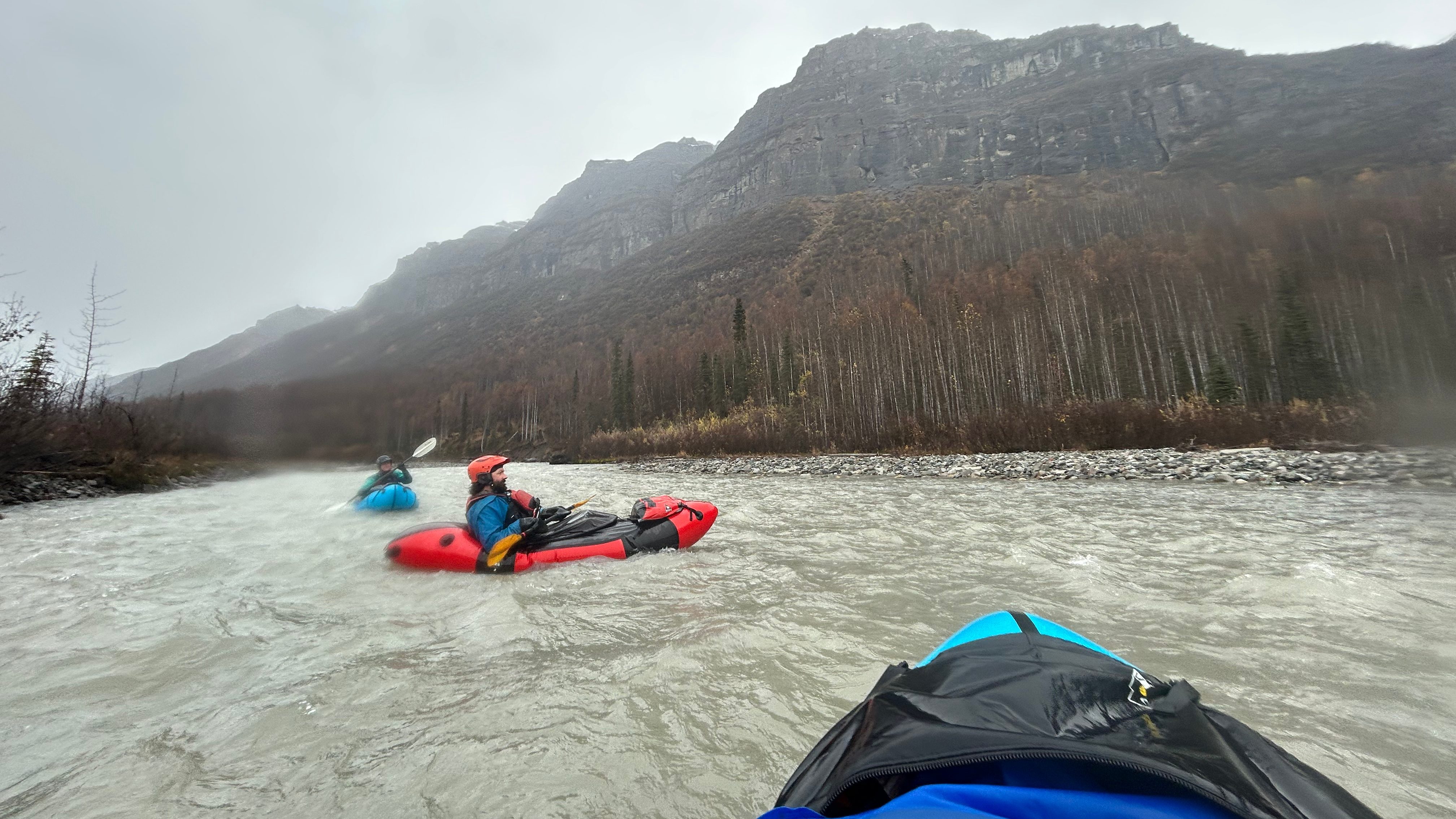
We continued on without thought until the river channelized. Here the whitewater became extremely fun as non-stop class 3 became the name of the game. After a few grin-inducing miles, we reached Hotel Rock (III+/IV+) where we scouted the entire rapid from the right shore. We had realized the river was very low from the moment we launched, and upon scouting Hotel Rock, we felt a sense of relief that we wouldn’t be dealing with the technical challenge that the rapid poses at higher flows. We easily ran the rapid without any drama, even finding a place to go through what would be a sieve at higher flows. As we went through the cave, we saw log jams over 5 feet above our heads; it was hard to visualize how chaotic this rapid would be at the flows that deposited that wood.
After Hotel Rocks, we went back to the joyful boogie water that had defined the run to this point. The next major feature we encountered was the Narrows and Pyramid Rock (II+/III+). We did not find it necessary to scout given the water levels, and our read-and-run went exactly to plan. We turned around after the choke-point to appreciate the stunning canyon we were in before letting the water carry us downstream into the day-hike portion of the run.
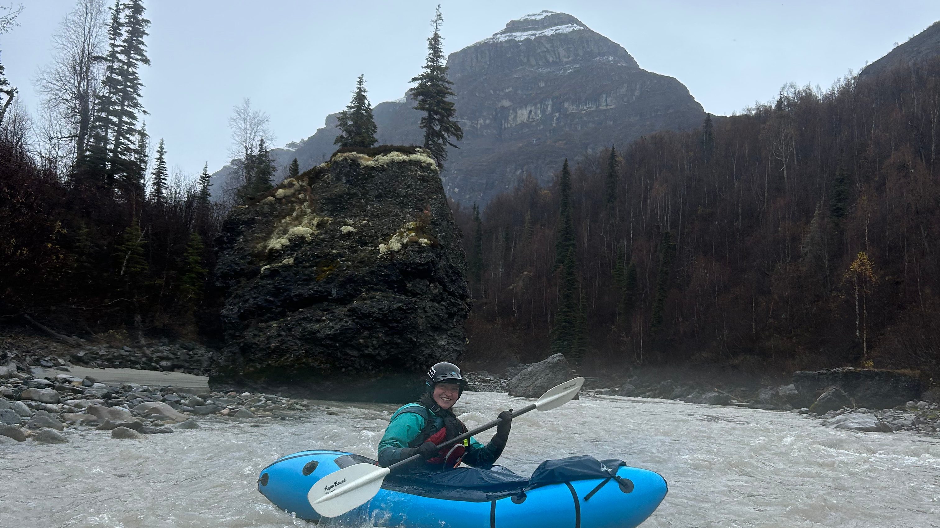
Below Pyramid rock, the river returned to non-stop fun, but the nature of it changed. Instead of boulder gardens and rock dodging, a shallow canyon begins to form which makes for more hydraulic features. Bigger wave trains, whirlpools, and boils began to appear. The variety in the water continued to impress me and we loaded up for Ledge Drop (III/IV). In the heat of the moment that was the lower canyon, we happened to run the rapid without even knowing it. The low flows that we experienced must have made the rapid disappear as none of us were exactly sure when we passed the rapid.
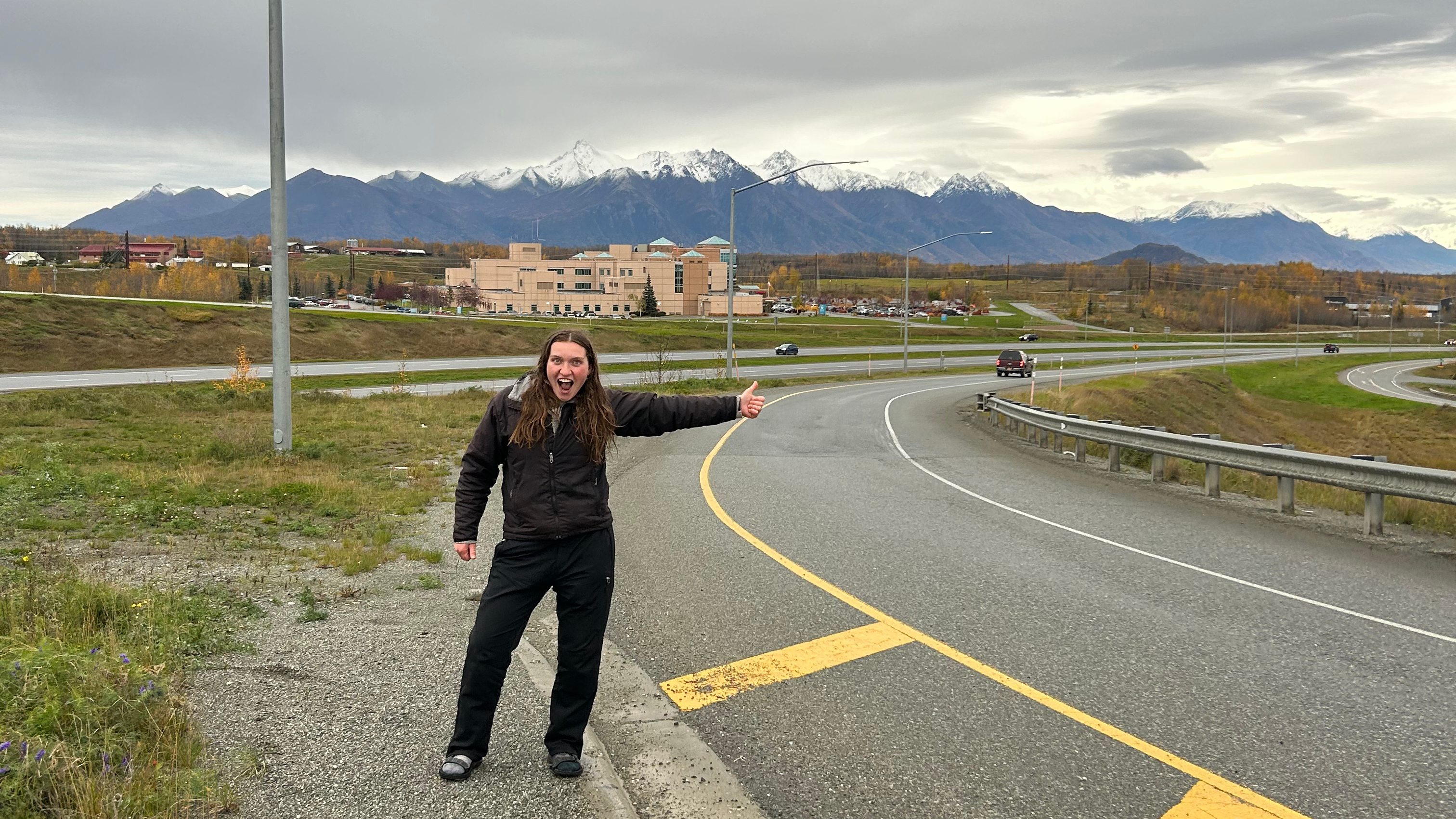
With the last of the challenges behind us, we enjoyed the last of the fun before watching more and more human evidence enter into view. Before we knew it, we had reached the Glen Highway Bridge that marked the end of our trip. We deflated our boats and began planning our trip home. Cody’s father was waiting on the highway so the two of them could head back to McCarthy while Olga and I began searching for a ride home. Quickly, a van pulled over and offered to get us to Palmer. We took the opportunity and from Palmer had no problem securing a ride back to Birchwood where our car awaited us. All in all, the day took about 9 hours, but at higher flows I would expect the mission to go much faster.

Leave a comment