5/9/25, 6/20/25
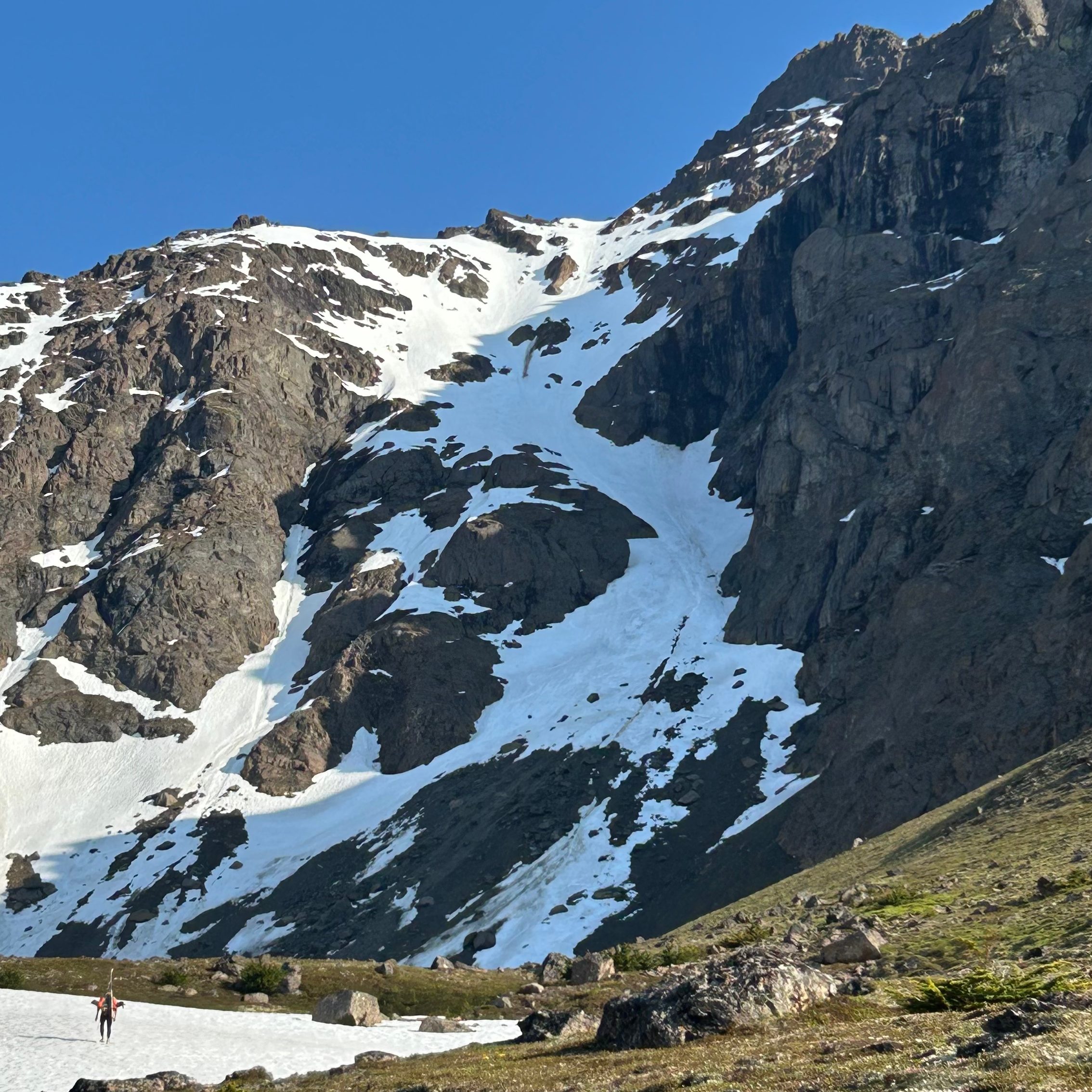
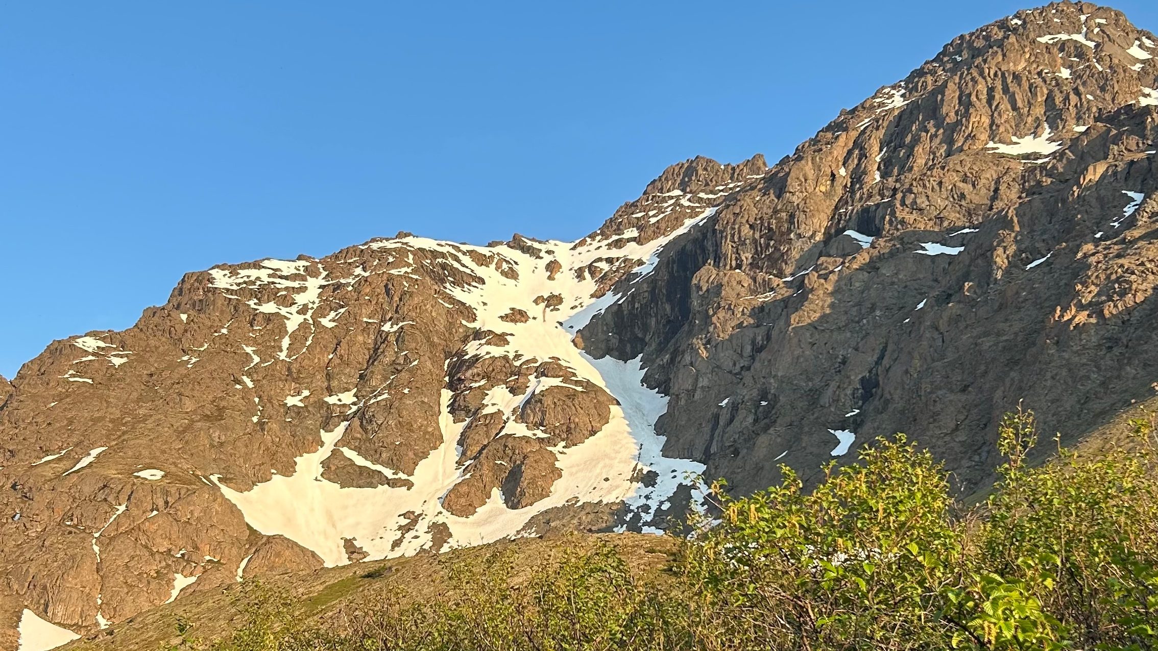
Rising above the houses that make up Anchorage’s Hillside region, Ptarmigan Peak is one of the many peaks on the ridge that divides the Campbell and the Rabbit drainages. On the steep north face of Ptarmigan Peak lives a ski line so obvious from town that any skier with a keen eye will eventually land their sights on it. In mid-winter conditions the line can fill out, but due to it’s steep and shaded nature, it tends to be skied into the summer when the line resembles the shape of the letter S—giving it the name Ptarmigan’s S Couloir.
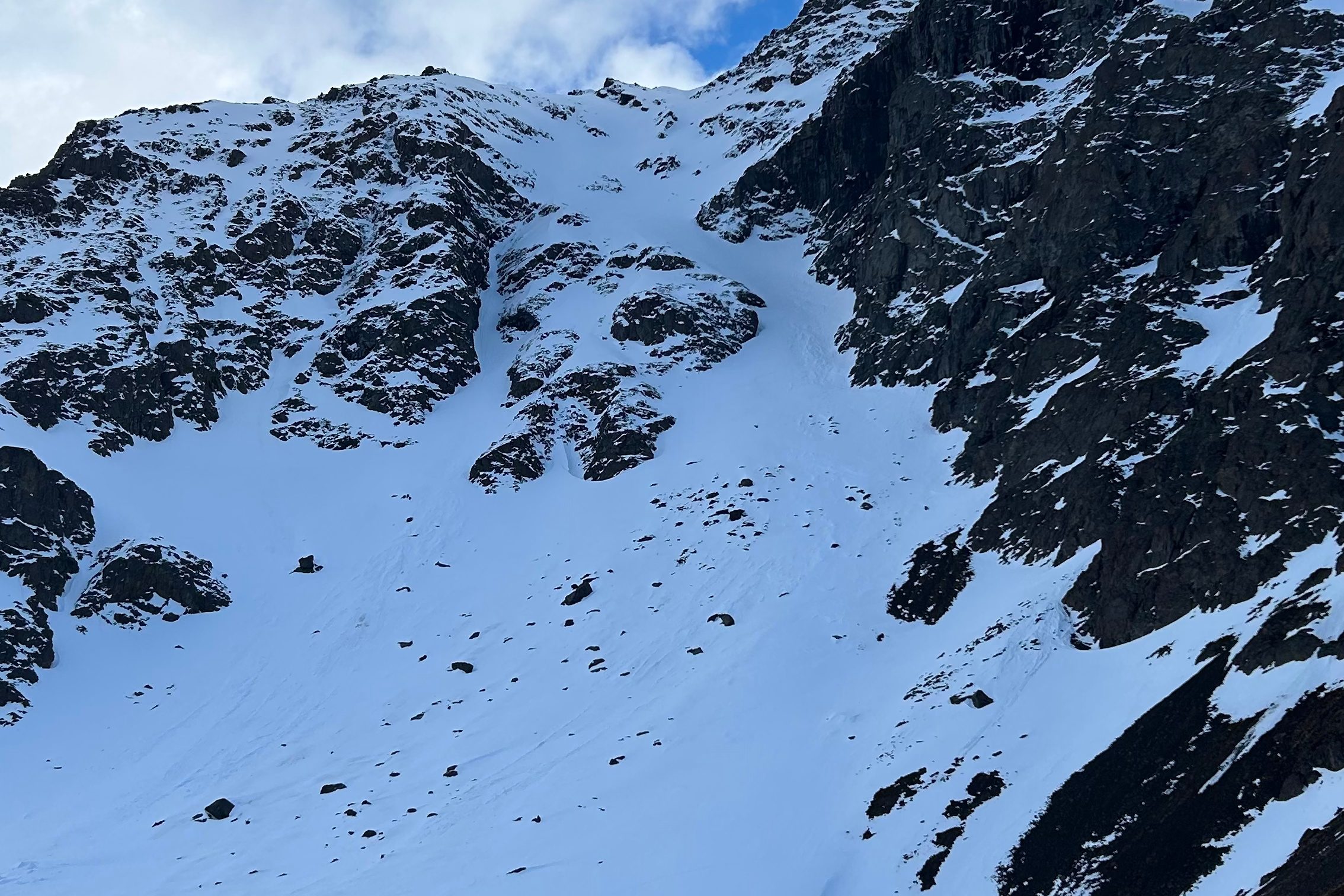
With 2,000 feet of fall line skiing, the S Couloir is divided into three distinct sections. The lower snow field, choke, and upper snow field. The lower slope is consistently steeper than 35 degrees and is rather wide, but even with room to spread out and navigate the terrain, you never feel safe as you trek over avalanche debris, small rocks, and even large boulders that have all fallen from the slopes above. As you climb towards the choke, you are funneled between the cliff you are climbing above to your left and an even larger cliff that rises above you to the right. Through this section, the pitch begins to approach 50 degrees, but I doubt it reaches that measurement. This portion of the line is the most stunning, with alpine rock and ice routes rising above you and no-fall terrain underneath your feet. As you pass through the choke, you reach a large snow field at the top of the ski line. The widening of the terrain allows for more room to navigate through the steep snow, but from here there is no easy way up that avoids exposure, you have entered no-fall terrain the moment you step above the cliffs that define the S. A straightforward romp leads you to a col underneath a false peak, this marks the top of the ski line. From here you could choose to scramble up to the false peak or the real peak of Ptarmigan, but most skiers elect to transition to downhill at this point.
On May 9th, I was working in the Hillside area which set me up perfectly to take a shot at the S Couloir. As soon as my day was over, I did the short drive up to the Glen Alps trailhead and began down the trail on dirt while in my ski boots. Quickly the dirt transitioned to snow which allowed for fast progress on my skis. After the 4.5 mile hike into the base of the line, I stopped to take a break and have a bite to eat. In this break, the ominous weather that sat over Powerline Pass quickly made its way to Ptarmigan Peak, and by the time I was having my last bite, I found myself getting snowed on at a moderate rate. While there wasn’t a massive amount of snow falling, it was enough to begin sluffing off of the upper slopes and due to the uncertainty and fact that I was skiing alone, I searched for a way to safely mitigate the new snow while still achieving some skiing.
I slowly worked my way up the lower reaches of the line and only saw more snow sluffing into the main line, so I made a game-time decision to pivot to the pinner couloir that lives to the looker’s left of the S Couloir. In fat snow years, this pinner can connect to the upper slopes, but given the low snow year of the 24/25 season and the fact that I was skiing into the spring, the line had a large cliff band separating it from the upper slopes. This meant that I would not be getting my 2,000 feet of skiing in, but given the circumstances I was happy to find something to ski. The reason I felt safer in the pinner was the lack of overhead hazard. While a massive slide on the upper slope would certainly bring snow down into the pinner, it was largely protected from sluffing snow and this minimized my chances of getting swept off my feet unexpectedly. Another relieving fact was that the pinner rises through the cliff band that defines the S, meaning a fall would not lead to me going over cliffs.

As the walls of the pinner began to close in, I felt the slope steepening past the 45 degrees I was expecting to ski that day. I continued onwards and the slope gained pitch every steep. Eventually, I found myself kicking one rock as I went to plunge my feet. A few steps later another rock; before I knew it there were more shallow-buried rocks under my feet than snow. It was here I decided to transition due to a combination of the rocks, the pitch, and the fact that the couloir was no wider than my skis were long. Before I fully transitioned, I was sure to pull a slope-angle on the slope and was pleased to find that it had surpassed the 55 degree mark and was approaching 60, a slope angle you do not find yourself skiing every day.
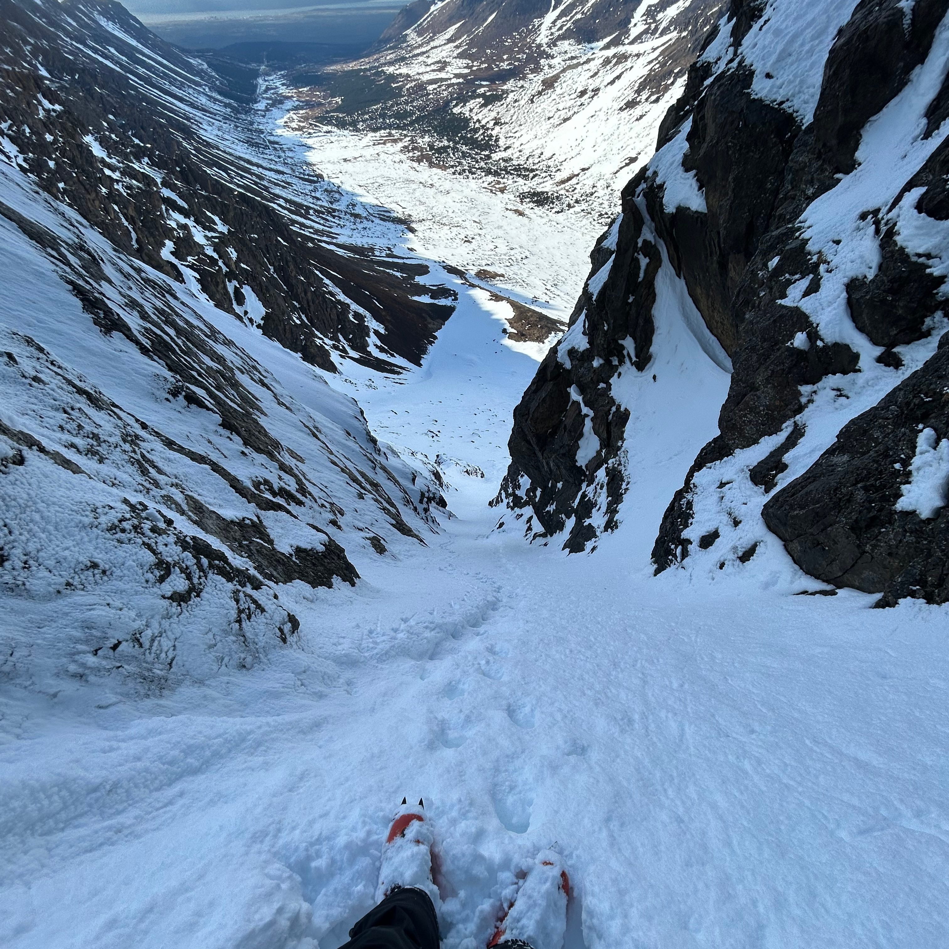
After a clean transition, I negotiated my line by beginning with some tail-walking. I had accidentally found myself in terrain too steep and narrow to comfortably make turns, but after 4 or 5 steps downhill I was able to make one jump turn, and then another, and in a few more jump turns I found myself in terrain that I was more comfortable linking turns in. Once I reached this point, I knew I had to ski quickly in order to stay in front of all of my fast-running sluff. I did just that and pulled over near the top of the apron to let my sluff dump past me. After allowing the snow to settle, I had nothing but a wide open apron underneath me. I enjoyed mindless steep turns throughout the lower portion of the ski, and in no time found myself looking up at the line I had just proudly skied. From here I was able to cover all of the distance that I skinned in a few minutes before throwing the skis on my bag and hiking out the dry portion of the trail.
While I was happy to check the pinner out, I left frustrated that I had not gotten a shot at the namesake couloir. I knew I would be heading back soon with clearer weather in the forecast, and because the S couloir holds deep into the summer, I was not too concerned about the timeliness of my return.
As summer days continued to lengthen I found myself watching the snow melt out of the couloir from my office at Merrill Field. On the longest day of the year a few things lined up to motivate me to bring my skis along with me to work. This year, the summer solstice landed on a Friday and there was hardly a cloud in the sky for the midnight sun to hide behind. After watching the weather through a window all day, I was soon driving up Toilsome Hill towards the Glen Alps. I indulged in a mediocre Wendy’s Baconater in the parking lot and next realized I didn’t have a T-shirt to tour in.
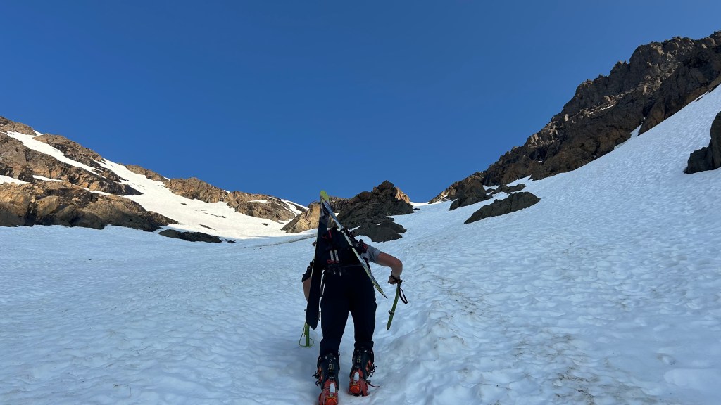
Swallowing my pride, I donned my backpack and took off in shorts and no shirt. I began the approach at a speedy clip, but recalibrated to a better pace to conserve some energy for the 2,000 foot climb ahead of me. While I was able to skin a good portion the previous time I was in the area, this time the approach was completely dry. Because of this, as I started getting close to the climb, two independent skiers approaching on their bikes passed by me. In their passing, we exchanged pleasantries and each of them expressed interest in the S Couloir. Once I reached the base of the couloir, I was able to catch up with one of the cyclists to do the climb together. As we started up, we enjoyed a good conversation that seemed to make the time fly by.
This time instead of being met with a squall and sluffing snow, nothing but blue skies and endless sunlight loomed overhead. The snow was soft and moveable, enough so that I didn’t see a need for crampons. As we pushed through the choke and steepest portion of the climb, I took a second to appreciate the water flowing down the near-vertical black wall that rises overhead; the alpine climbing routes up the wall look a little different when the ice has returned to its liquid form.

In the final push towards the col that marks the top of the ski line, the second cyclist who had passed me caught up with us and joined in the line of stair-stepping 40+ degree snow. With the social relief of a third person, we were at the top of our line before we knew it. From here I pitched continuing upwards to gain the false peak, but neither of my new friends had any interest in continuing on. While it seemed like a noble effort to stand on a high point, I came for the skiing and without anyone else interested in continuing to climb, I was happy to strap the skis on and go for a ride.
Following a long break at the top, we each took off down the couloir one by one. I skied last, but since we were on summer snow, the marginal difference in first and last tracks was negligible. The top half of the line was immaculate; soft corn in the golden sun that only touches the north face for a few weeks of the year. As the line choked down, the sunlight began to disappear and firmer runnels formed by all the debris that comes racing down the choke defined the following turns; however, just beyond the choke the snow softened up again and returned to its soft nature. Below the choke, we sidehilled to the right in order to avoid the dry slope beneath us. As we neared the bottom of the line, there began to be nearly as many rocks under our skis as there was snow, but light thoughts and precise turns found everyone at the base of the ski line without a core shot.
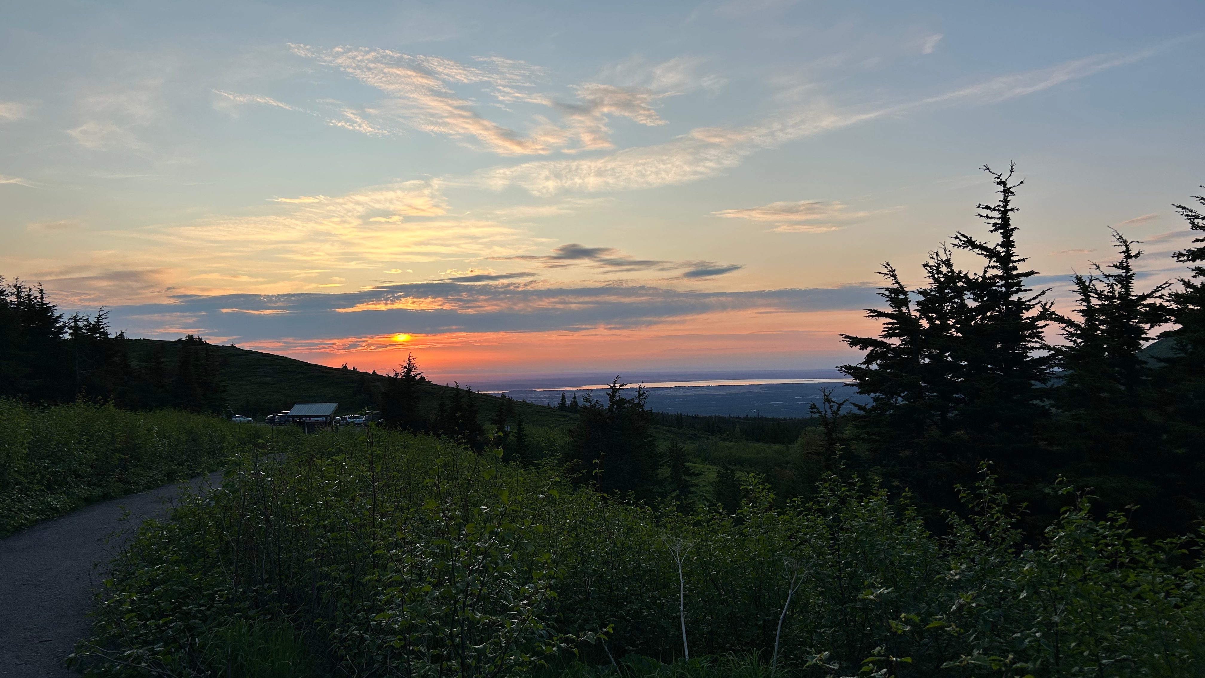
As we looked up at the line, we all felt proud to claim such an aesthetic line on a day celebrated by so many Alaskans. As we said our goodbyes, I was extremely jealous of the other two for having their bikes, but I was at least happy to know the majority of the hike would be downhill. I watched as the two cyclists made out ahead of me, tossed in my AirPods, and enjoyed the prideful walk back to the parking lot. As I was nearing my car at 11:30pm, I was greeted by a stunning red sky with the sun behind thin clouds that had rolled over the western Alaska Range. I took a moment to appreciate the wonder of nature that is the midnight sun, the amazing skiing that we have year-round in Alaska, and all of the crossroads in my life that had led me to this moment.

Leave a comment