4/3/24-4/13/24
“Call me when you can, I’ve got a trip to pitch.”
When I looked down and saw these words lit up across my phone screen, I knew I was in for a long phone call. When Cody Simmons comes up with an idea, every detail is ironed out before a word is ever spoken; consequently, that means any idea that has made it past Cody’s brainstorming phase is a big one that should feasibly go, but would need a pitch to convince any sane man to join along for.
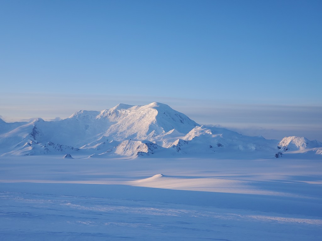
I quickly made the call, and was swiftly debriefed on the plan to do a traverse from 7,500 feet elevation on the Nebesna Glacier to the Nebesna Road at mile 28. Along the way, we had the opportunity to climb a few notable peaks, most obvious of those being Mt Jarvis with its summit at 13,421 feet. Other options included Mt Wrangell (14,163ft) and Zanetti (13,009). The plan included an exit on the north side of the range, and included descending the Copper Glacier, across many lakes, and eventually ending on the road. Knowing this was likely going to be my only opportunity to get into Wrangells this spring, I agreed to the trip and proceeded to get to know the plan better.
Along with Cody and I, a third member was meant to join us, but he unfortunately had to cancel at the last minute. With the plan we had drawn up, this took our Denali 100Ls right to the edge of their capacities, and thankfully we were able to stretch our bags and fit all of our gear into it the day before our flight. We stayed the night in Gulkana and watched Drum and Sanford; it was obvious there was weather trapped up in the heart of the Wrangells, and our flight the next day was going to need to find a way through it.
The next morning, Cody drove to Tok, and I headed to Chistochina. He was going to fly in first off with Tok Air Service, and I would come in next. We were met with a few delays in the morning, but Zack showed up to the strip right in front of Red Eagle Lodge around 12:30pm. I loaded up and hopped in his beautiful blue and white Supercub. As we taxied down the runway, he asked if I was prone to motion sickness. He was very relieved when I said no. This was all I needed to hear to know what the weather was like up high.
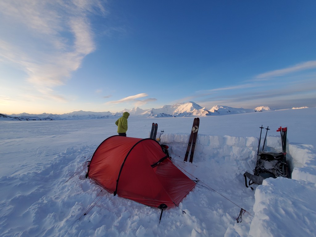
After nearly an hour flight, we reached the LZ, a flat spot at 7,500ft between two lobes of the Jacksina Glacier. As we cleared our last pass, we had a small window to put the plane down before weather blew back over. He made it work, and just as quickly as he put the plane down, he had it back up in the sky getting out before he was stuck.

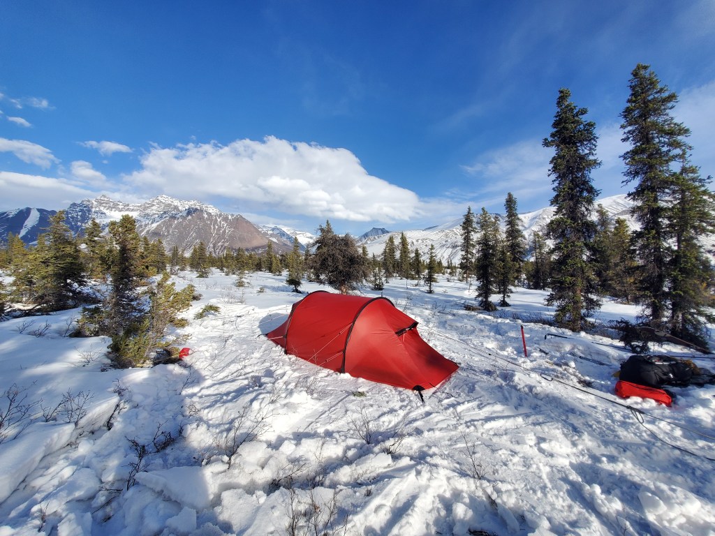
I ran into the tent and Cody and I made a plan for the rest of the day. After we broke down the shelter Cody had built to wait for my flight, we began off towards Jarvis, unsure of how much ground we might cover. Heavy packs and elevation made for slow movement, but soon enough we had moved 4 miles and were losing sunlight. In those miles, The views around us never seemed to shift in perspective. It was here I realized how big of terrain we were in. We decided to set up camp in the middle of the glacier, and were lulled to sleep by the consistent 25mph winds hitting our tent.
We woke the next morning to partially clear skies with similar winds that rolled in the evening before. We had a bit more than a mile before we approached a rocky outcropping that we could use as a handrail if the weather rolled in. Approximately halfway to the rocks, the weather rolled in with a heavy energy. Not only did winds pick up, but it began snowing as well. We quickly decided we needed to prioritize a good shelter over movement, so when we passed a deep moat next to the rocks, we made the call to stop the day there. Moving any further would have only invited uncertainty into the day, and I was happy to take the time of a half day to acclimate to elevation.

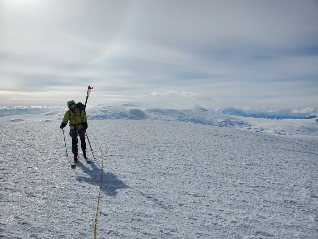
Having learned our lesson, we woke early on day 3 in hopes to beat any weather that might move in later in the day. While the winds were slightly less and the snow had stopped, we still found ourselves in the ping pong ball. To begin the day, we were privileged enough to have our handrail of rocks to follow, but these quickly were consumed into the disorienting whiteness of Nebesna Glacier. From here, we navigated by compass and found our way to 9,500ft at the base of Jarvis. We found a spot with deep enough snow to build a camp, but the fact that this was a problem was very curious to us. It seemed the winds had been ripping through the Wrangells so much that there was a concerning lack of snow depth.
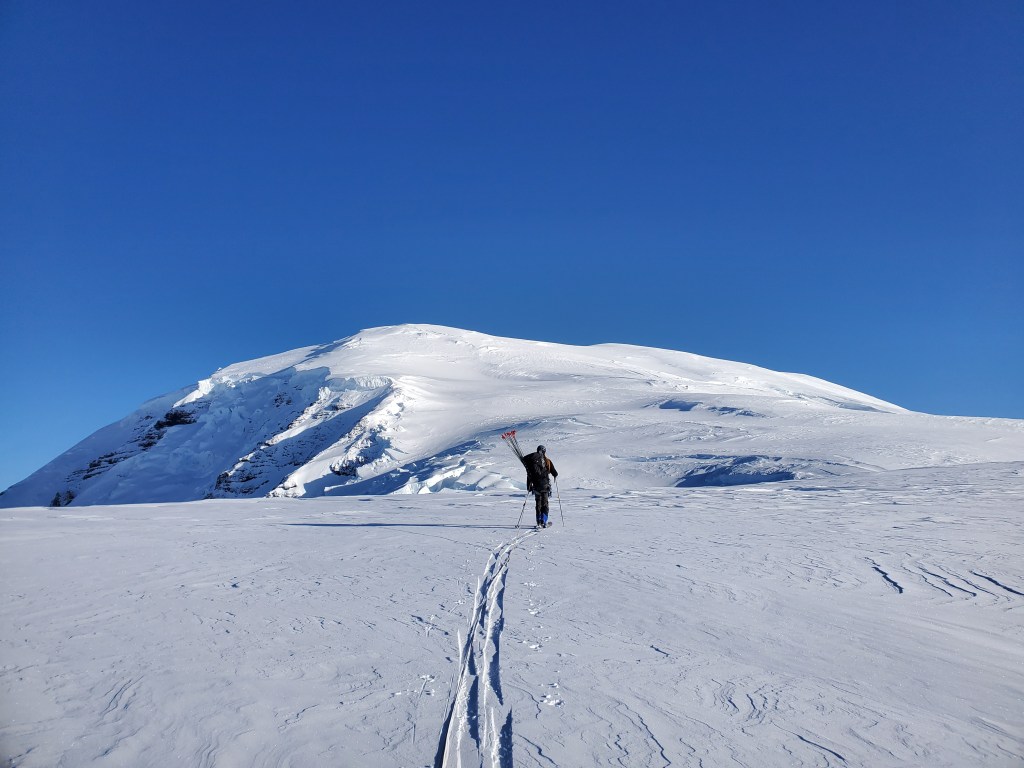
Our camp withstood the now expected increased winds of the evenings, but we were fully consumed by the clouds and had no visibility to make movement possible. With the alarm clocks set early, we went to bed hoping skies would clear the next day. Unfortunately, this was not the case, and we were forced to take a camp day if we wanted to climb Jarvis. We set our alarms early the next morning, and were pleased to find fully bluebird conditions to start the morning. We made food, packed out day packs, and headed out knowing these were the best conditions we had seen all trip. Things were going very smoothly for the first bit, but once we reached around 10,250 things began to get more complex.
Crevasses were beginning to show their faces through thin snow bridges, but nothing too large had appeared. It was on a complexly shaped convexity in the snow that I found myself keeping my skis perpendicular to the direction of the last crevasse I saw when I suddenly felt the snow underneath my skis collapse. I only have a moment to realize what I’ve done before I’m tumbling down the crevasse. Oddly enough, you’d imagine falling in a crevasse to be one of those slow motion moments, but I only remember the snow collapsing under my feet and then looking at my legs to make sure nothing was broken after I landed on them on a snow bridge around 20 feet into the crevasse. Miraculously everything seemed mostly okay other than a pretty painful nose, but I will take that over any lower body injuries when you are 60 miles from a road and on a glacier.
With no way to tie my skis and bag off, I found ascending the rope to be impossible, so I had Cody haul me out of the hole. As I surmounted the lip of the crevasse, I took a moment to think about the possible outcomes of what had just happened. I then took a moment to think about how this should affect our day. While I felt extremely lucky to have made it away from the event largely unscathed, I knew there was no reason to call off our only hopeful day for a summit. I announced it’d be a shame if I got that lucky and it still turned us around, and we began our way through a minefield of other cracks. Through this section, it’s safe to say I may have overprobed.
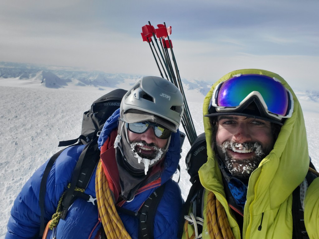
We swapped between skis and crampons a few times throughout the rest of the climb, with a good section even sidestepped with skis on (not recommended). Upon reaching the plateau before the low angle summit push, we donned our heaviest puffies and Alti Mitts. After a full day on a mountain that never seemed to change in uphill views, we could finally see a defined peak. I was surprised with how short the tour to the peak ended up being. Upon reaching the domed summit, we took a few pictures, but elected to ski back to warmth quickly.
We skied off the peak with skins on; once we reached the main fall line, we ripped skins and continued on the 4,000ft ski to our camp.
Briefly, skiing seemed to subdue the effects of elevation, but I think that was just the adrenaline of knowing we were on the way down as it subsided only a few turns into the ski. We chose to ski on a rope due to the amount of cracks we found on the uphill. These two things combined led to a less than enjoyable time throughout the top portion of the ski, but once we were lower and in warmer weather a break was due. After refueling for the rest of our ski, we took off, finding the turns to be easier to connect in a thicker atmosphere. The snow quality remained poor, but edgeable at least. As we went back through the cracked up section we found ourselves straight lining and jumping crevasses in rhythm. The lower nearly 1,000 feet of the ski proved good with a nice firm consolidated powder layer over a lack of crevasses. Turns out our best turns of the trip would be found right above camp.
We reentered camp and quickly got the stove firing to melt water and cook our Mountain House Meals. We agreed to sleep in the next morning after the 11 hour summit day.
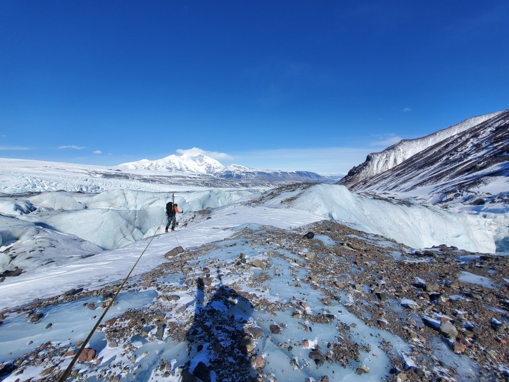
The next morning called for us to move camp in preparation to gain the Copper Glacier. With the way the snow bridges looked on Jarvis, we knew we had our work cut out for us navigating our way to the road. We woke to poor visibility, but had the whole massif of Jarvis as a handrail for the next few days. We started out from camp keeping Jarvis within view on our right side. There were some buried ridges coming off the mountain that made for complex terrain and the possibility of big crevasses.

We slowly navigated this terrain and used our best guesses for where to sneak through challenging looking sections. Somehow things went largely swimmingly this day, and we put ourselves above a pass we had labeled as the “Sneak of Sneaks” on our maps prior to the trip. We set up camp directly next to the Sneak of Sneaks, and set ourselves up for an early morning start down the 1,800ft descent of the pass.
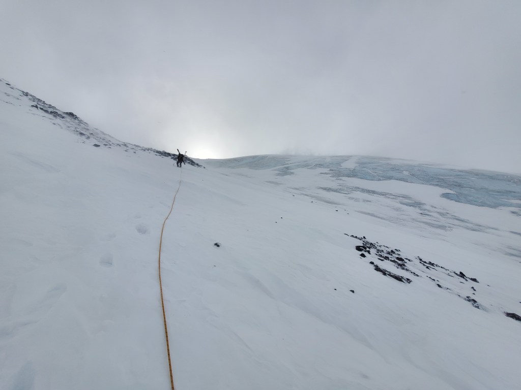
We woke to partially clear skies, some of the better weather of the trip. This was important so we could try to scout out our line down the pass. Our blind guess took us over a cliff band, but a nearby snow field seemed to connect to the valley floor. Neighboring snow fields all seemed to end in cliffs or on steep blue/grey ice. It seemed ours was the best option of the bunch, and began with fun frontpointing until the angle pitched slightly down and we transitioned to walking down the snow. If we were braver, this would have been an amazing ski.
We put our skis on at the bottom, and began to follow a highway of glacier ice that lived between two lanes of moraine. We were now on the Copper Glacier, and after turning to look at what was above us on the glacier we realized our sneak was likely the right call. Massive ice falls seemed unavoidable in the vast glaciated valley. Luckily we were below this mess, and on a mostly flat piece of the glacier.

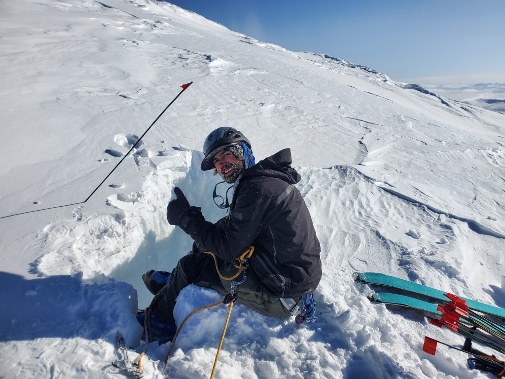
As our highway began to peter off, we found ourselves moving through a thin layer of surface moraine on top of glacier ice. It was in this environment that I watched Cody’s body disappear beneath the snow surface. I quickly leaned on my edges and felt his weight on my harness. I dropped to my side and put in a picket so I could lean over the edge of the crevasse he had just fallen into to make communication with him. He announced he was ascending out and I went back to the anchor to back it up. As he came over the edge bloodied, he announced I needed to go get his skis and bag.
I gave him my warm layers, and quickly descended into the hole. First mission was to get his skis, one of which had fallen to the bottom. With just enough rope to reach the fallen ski, I forced myself deep into the constriction at the bottom of the 60 foot deep crevasse. I came out with the skis, and headed back in with a drop loop to haul the pack out. It was on the hauling that we managed to break the top strap of the bag. At this time I began to feel very sapped of energy, almost to the point of being sick. Cody offered to go back in and ascend with the bag out, and by the time he was back out I had realized the mistake I had made in giving him all my warm layers.
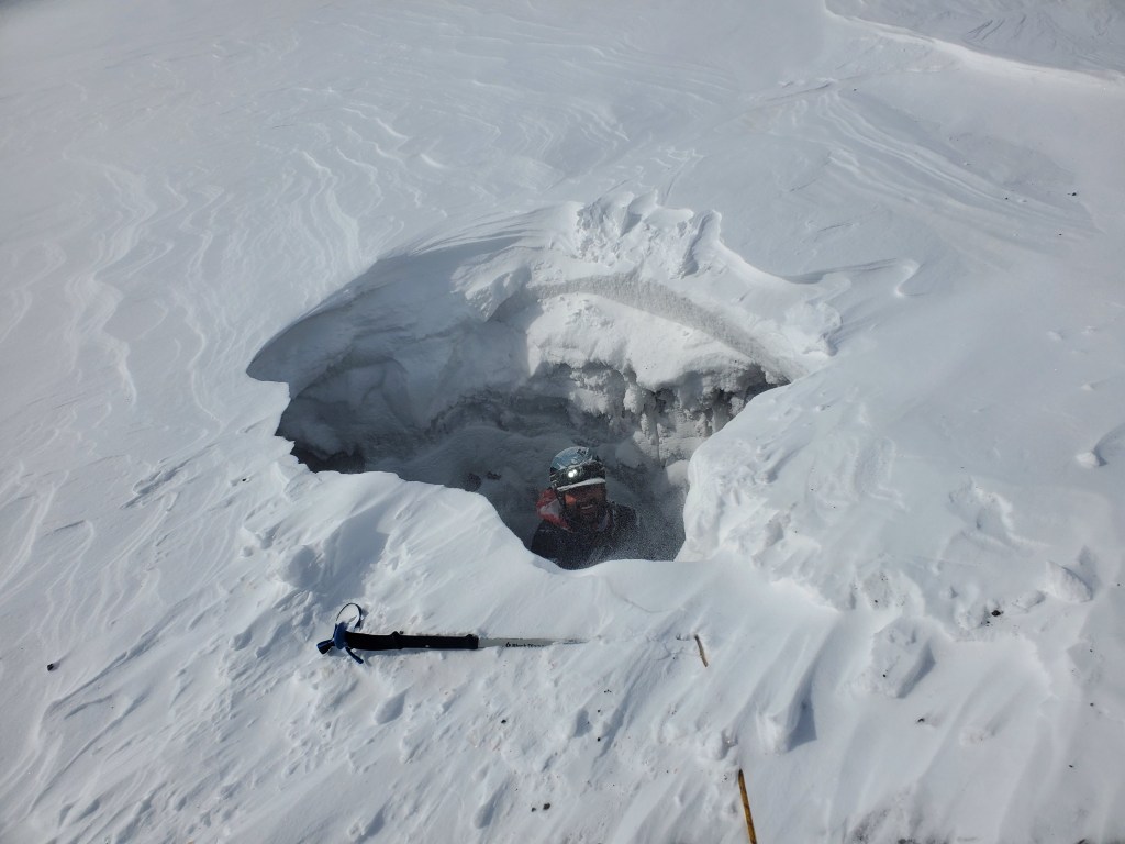
I had gotten too cold, and after spending over two hours in the hole getting his gear, I had let the frostbite get me. By the time we had all the gear out of the hole, it was past 5pm. We probed heavily and found a nearby patch of snow that could accommodate camp. Both worked and beat up from the day, we did not have a problem falling asleep.
In the morning I realized my blistered fingers and red toes. I knew I had messed up when I went to bed, but now I had to start dealing with it. The only option was to keep moving but with more care towards keeping them warm.
Being careful to not sleepily walk into the crevasse positioned a few feet from our tent, we got moving early the next day. We knew progress would be very slow with so much uncertainty in crevassing. After an hour of moving, we had made it about a quarter mile from camp, but the glacier seemed to mellow out in the near distance. Instead of messing around on the ice all day, we found ourselves to the lateral moraine on the side of Jarvis.
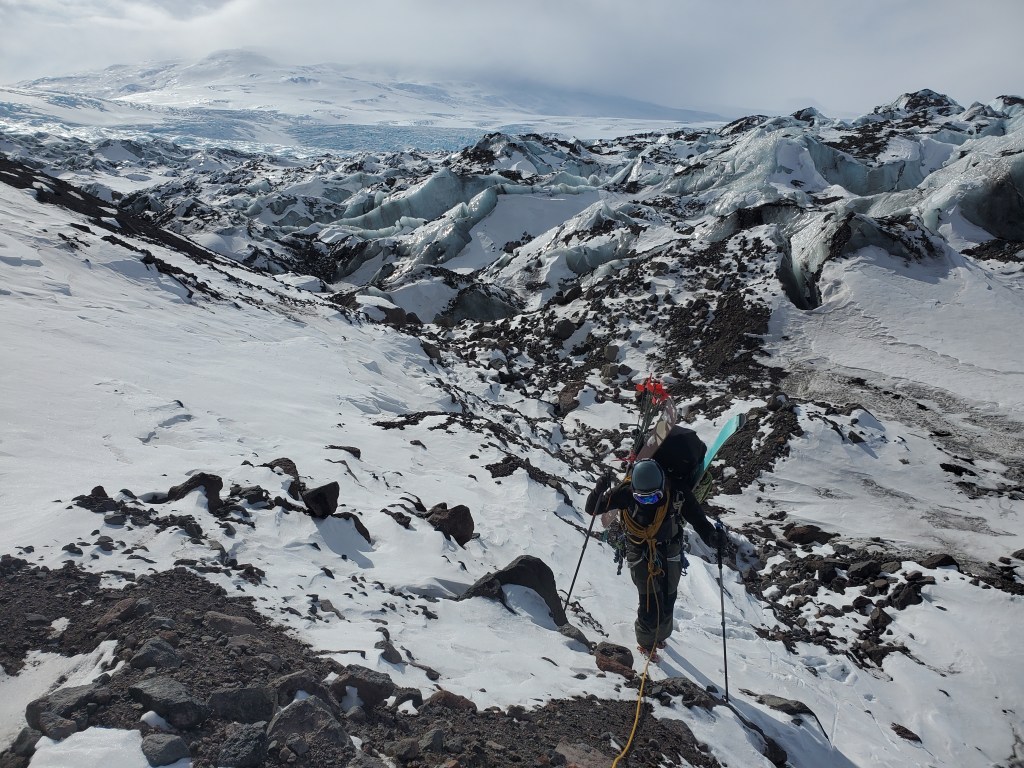
From here, we made quicker progress, but the constant transition between skis and boots kept us humble. Rock fall rained from above, and we knew we couldn’t rely on the moraine forever, but as we made our way down glacier we started to see an obvious weakness in the ice. After spending a good portion of the day on moraine, we found ourselves back on ice. There were pockets of snow that had held on through the relentless winds, but we ended up walking with our skis on blue ice for longer than anticipated. Eventually we found a camp that had just enough snow to pitch a tent in.

From camp we were less than 10 miles to the tundra. Looking up and down glacier told us that the hardest parts of the trip were now behind us, and we slept peacefully knowing we were in the home stretch.
Early the next morning we started off with crampons on blue ice. After around 5 miles on the Copper Glacier, we began to drop off on the skiers left side of the ice. We found a large silty basin where the West and Copper glaciers used to confluence. It was here we took a long break and enjoyed the feeling of something soft under our feet. Following our break we descended to the West River.

With katabatics ripping down the river right off of Sanford, we decided to put the skis on without skins and see how well we could skate across the river ice. The winds blew us down the ice at a speed teetering on scary, but it was a relief to utilize an energy source to move us instead of continuing to walk.
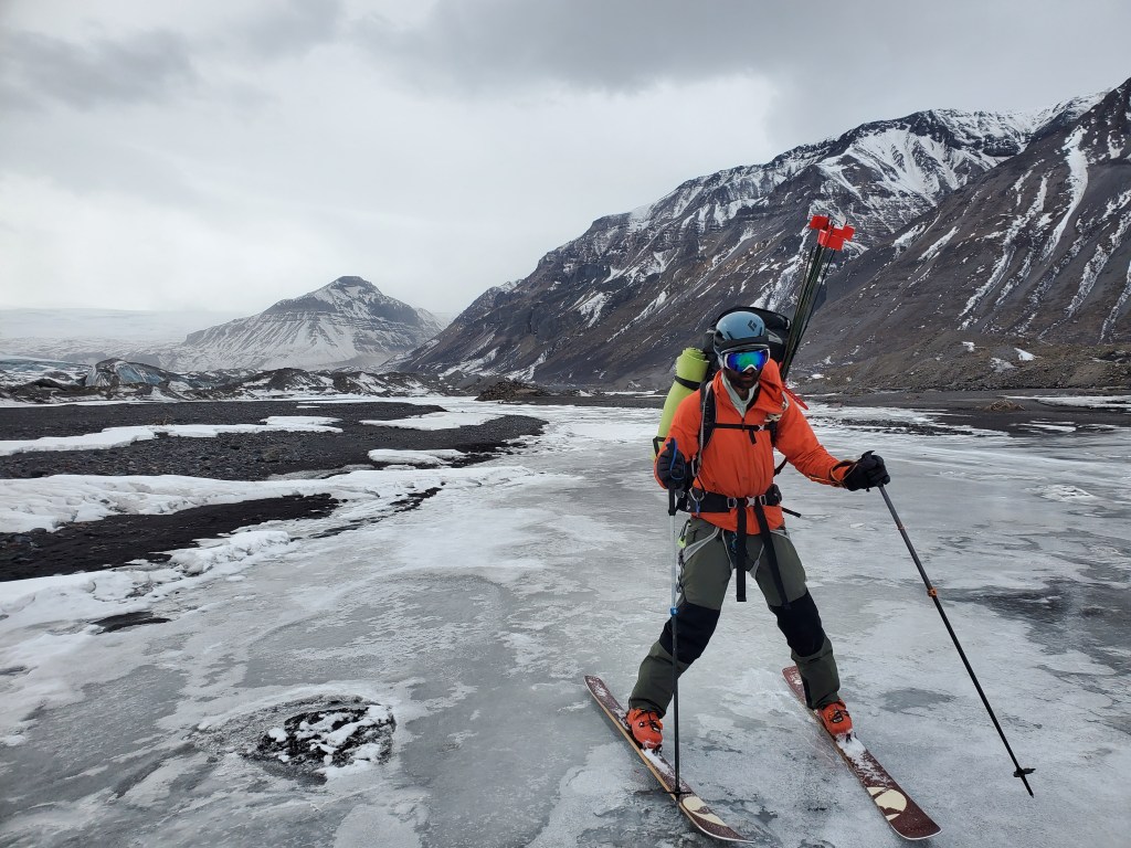
After the quickest and easiest miles of the whole trip, we reached Mud Lake. It happened to be holding very wet snow that threatened to soak our skins. It was here we applied kick wax to our alpine skis, and began using the wax to propel us across the lake.
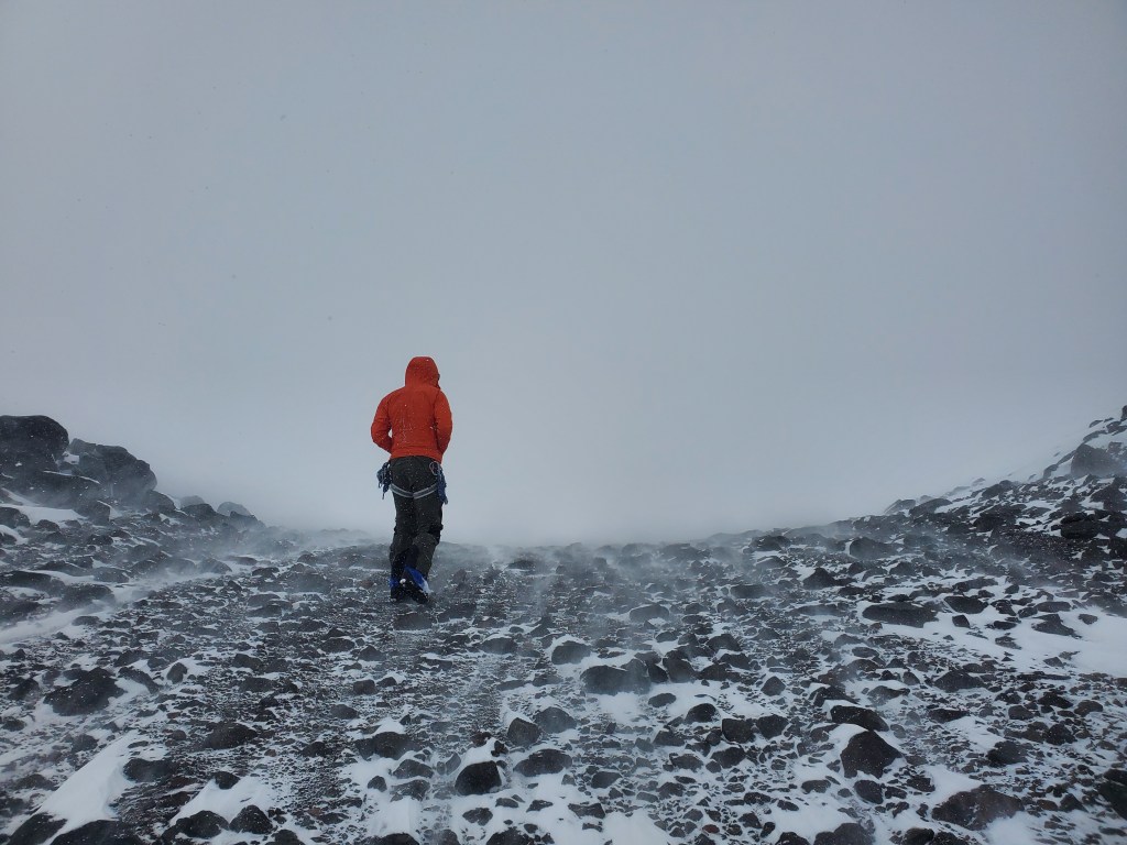
Just beyond the lake lived the tundra that served as a reintroduction to vegetation for us. We walked with our skis on horribly baked isothermal snow for a few miles looking for a snow machine trail east of Mt Fusil that I had spotted from the plane ride in. On the verge of giving up, I decided to take a long break. In this break Cody dropped his bag and ran off ahead to try to find the trail. I took the time to study my pictures and the map and finally pinpointed where the trail was. Cody returned and I explained he must have been close to the trail, so we headed back together and found the trail just past where he had gone. We built camp here and enjoyed the change of scenery that we had walked into.
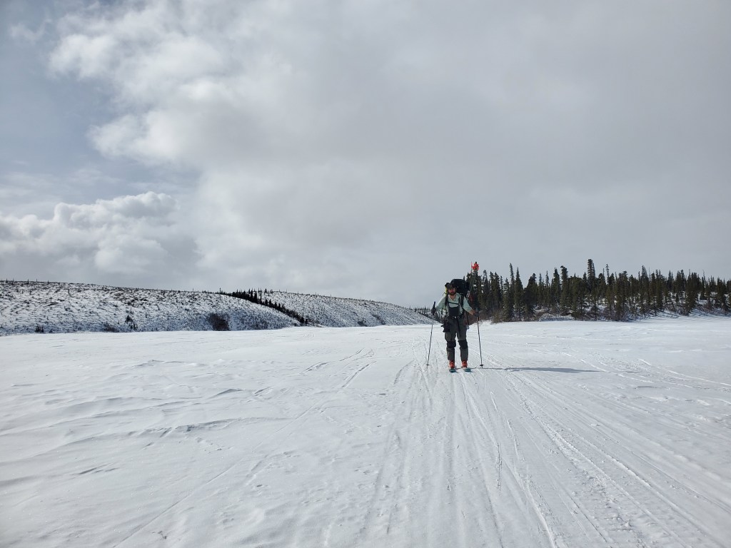
The next morning started a set of high mileage days through the Alaska lowlands. My favorite thing to do…
We started down the snow machine trail at our own pace the next morning; the trail started through a beautiful open glacial valley with views of Fusil, Jarvis, Wrangell, and Tanada peaks. As we moved through the valley, vegetation continued to become denser until we found ourselves in a spruce forest. We pushed through this forest for many miles, until we reached Copper Lake. We were at a 13 mile day before we reached the 5 mile long copper lake. When I reached our camp on the far side of the lake, Cody had already fully set up. Turns out he beat me to camp by nearly an hour and a half, a testimony to his all day fitness.
A deep sleep left me rested for the next day. When we awoke, we both had the road in our minds, it was just a matter of when we would reach it. We began down a trail that connected Copper Lake and Tanada Lake. Setting a good time got us through Tanada Lake before we could register how quickly we were moving. At the mouth of the Lake, we followed the stream and began hopping between small lakes left behind by glacial recession. On these lakes we were spotting caribou in large numbers, seemingly migrating on through. Eventually we found ourselves on Jack Lake; we followed snow machine trails to an exit that clearly headed to the road. After a 14 mile day, we began to see roadside buildings.
The boost in energy made it feel like we ran from the lake to the road, but I’m sure an outsider would describe it as something between a hobble and a limp. We dropped our packs on the road and sat for a while enjoying the fact that we had made it out successfully.

Our hopes were to hitch a ride down the Nebesna Road, but as we waited on the road we never saw a car heading in either direction. After a few hours of waiting, a call was made for a pickup. It was after 5 hours of sitting roadside that our ride arrived; Richard from Red Eagle Lodge had driven all the way out to pick us up. We elected to stay at their lodge that night, and had an amazing time exchanging stories and learning about the adventures both Richard and his wife Judy have lived. I would recommend everyone stopping at their place and spending a night with them, they are a gem of the Western Wrangells.
Our trip into the Wrangells provided exactly what I was hoping for. We were tested both physically and mentally, and I felt the opportunity for growth to be ample. Plenty of time was available to reflect, and I feel I was given the chance to work through many thoughts that don’t often get prioritized. Least importantly, we were able to get a big summit and travel down a glacier with limited literature of human travel. To come up with negatives of the trip seems easy, but I consider all of the challenges of the trip to be valuable moments of growth.
I look forward to heading back into the Wrangells, but one big mountain trip was enough for the spring of ‘24. The next two trips I had planned were both a step down in intensity when compared to this trip, and that was okay with me. Read about my Delta Range trip and Peter’s Creek trip for more information!
All photos belong to Cody Simmons.

Leave a comment